Which parts of the area are included in Pokesdown?cont’d
A PDF of the maps is available here where they can be enlarged for easier viewing. Images can also be clicked on to open a higher resolution image in a separate tab.
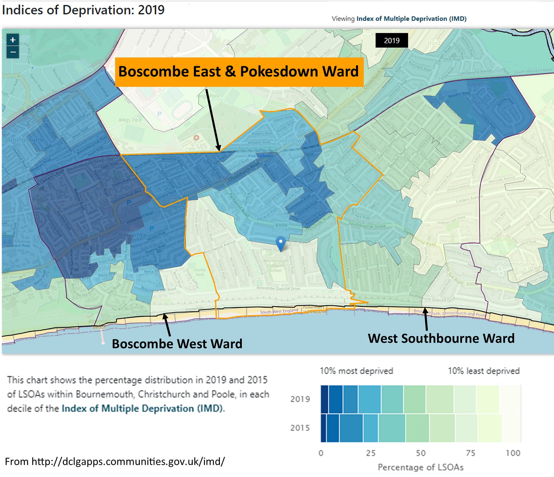
This is the modern-day political ward of “Boscombe East & Pokesdown”. It was previously called just “Boscombe East”, even though it always included Pokesdown, but the name was changed in October 2018:152
Click on image for higher resolution version.
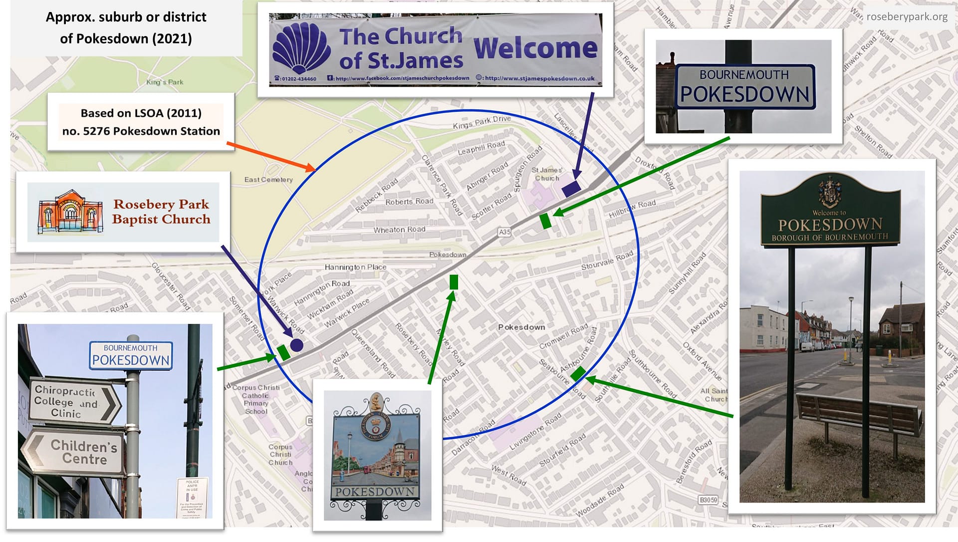
This map shows the modern-day (2021) boundary of the suburb or district of Pokesdown – a much smaller area than the other Pokesdown boundaries, but Rosebery Park Baptist Church is still in it (both current location and site of original chapel)! The original C of E parish church, St James, is still here too.
Map of suburb or district of Pokesdown today (2021), including showing original parish church of St James.153 Click on image for higher resolution version.
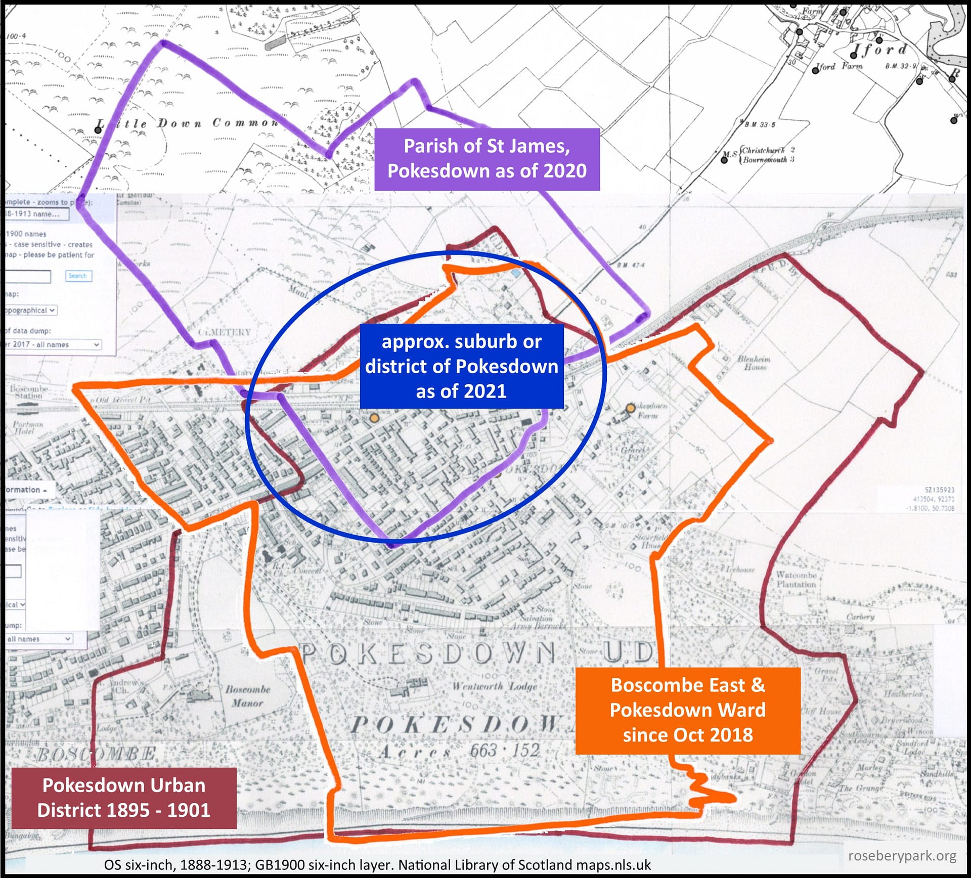
The next map shows the modern-day boundary for the Parish of St James, Pokesdown, over-laid with the boundaries for the 1895 to 1901 Pokesdown Urban District, the 2018 Boscombe East & Pokesdown Ward, and the area locals today might consider to be the suburb or district of Pokesdown. And this is why it’s difficult to say where Pokesdown begins and ends – what year and which aspect are being discussed?!154
Click on image for higher resolution version.
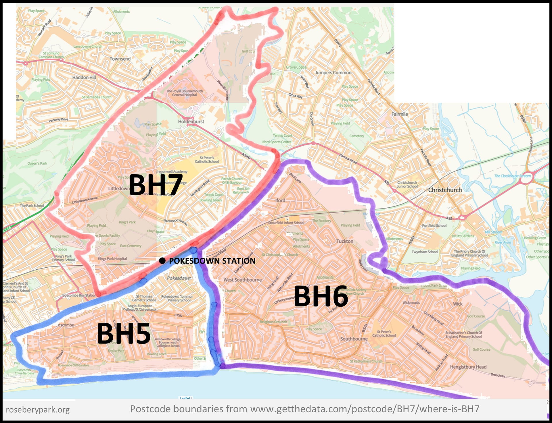
By postcode boundaries, Pokesdown is split, with the north side of Christchurch Road falling into BH7, and the south side into BH5, so postcode boundaries are not a help in defining where Pokesdown is! BH6 starts just to the east of Southbourne Road.155
Click on image for higher resolution version.
The copy and paste citation for this page: The History of Rosebery Park Baptist Church and Pokesdown – Pokesdown: its boundaries, Page 2. Author: Michelle Fogg. Date: May 2022. Url: https://roseberypark.org/history/pokesdown-boundaries-2/
Rosebery Park Baptist Church, 812-814 Christchurch Road, between Boscombe and Pokesdown, Bournemouth, BH7 6DF
Which parts of the area are included in Pokesdown?
A PDF of the maps is available here where they can be enlarged for easier viewing.Images can also be clicked on to view higher resolution image in a new tab.
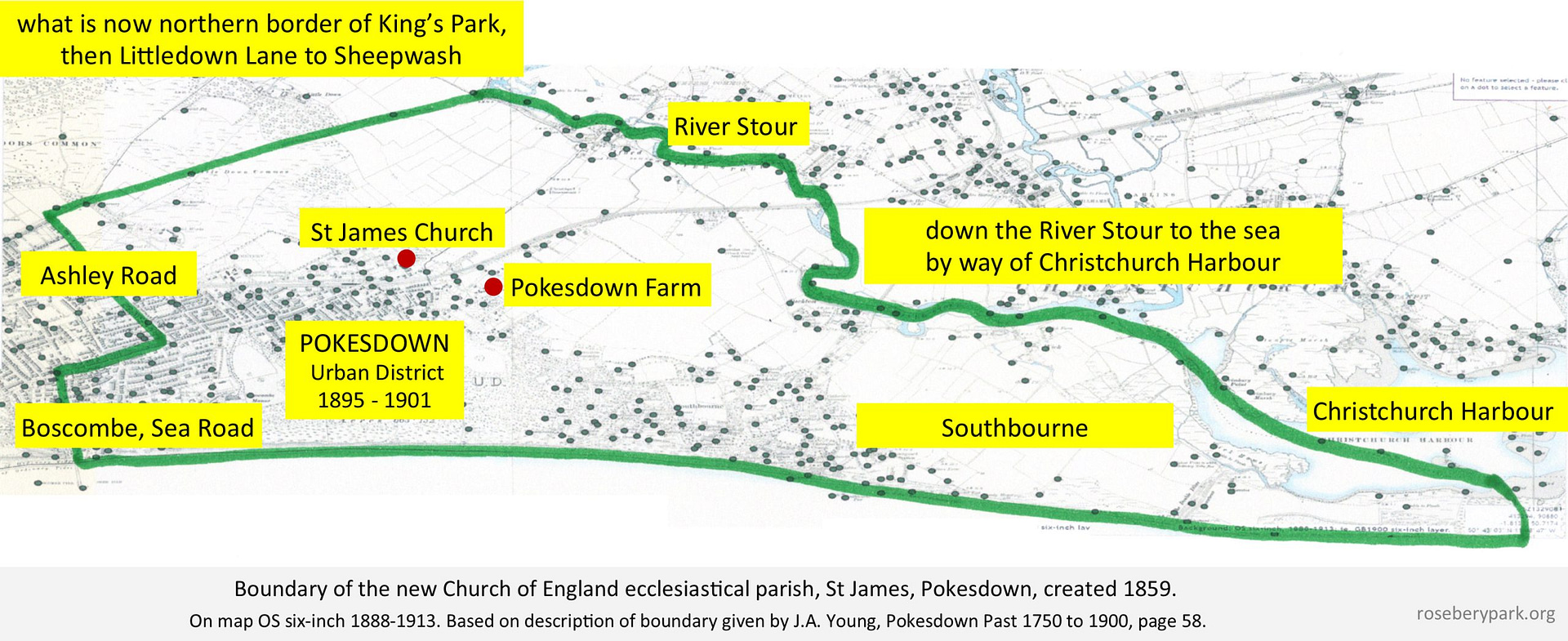
Here is a map showing the 1859 boundary of the then new Parish of St James, Pokesdown – based on the description given by J.A. Young147 – note, it covers a MUCH larger area then we are used to considering as Pokesdown!
Click on image for higher resolution version.
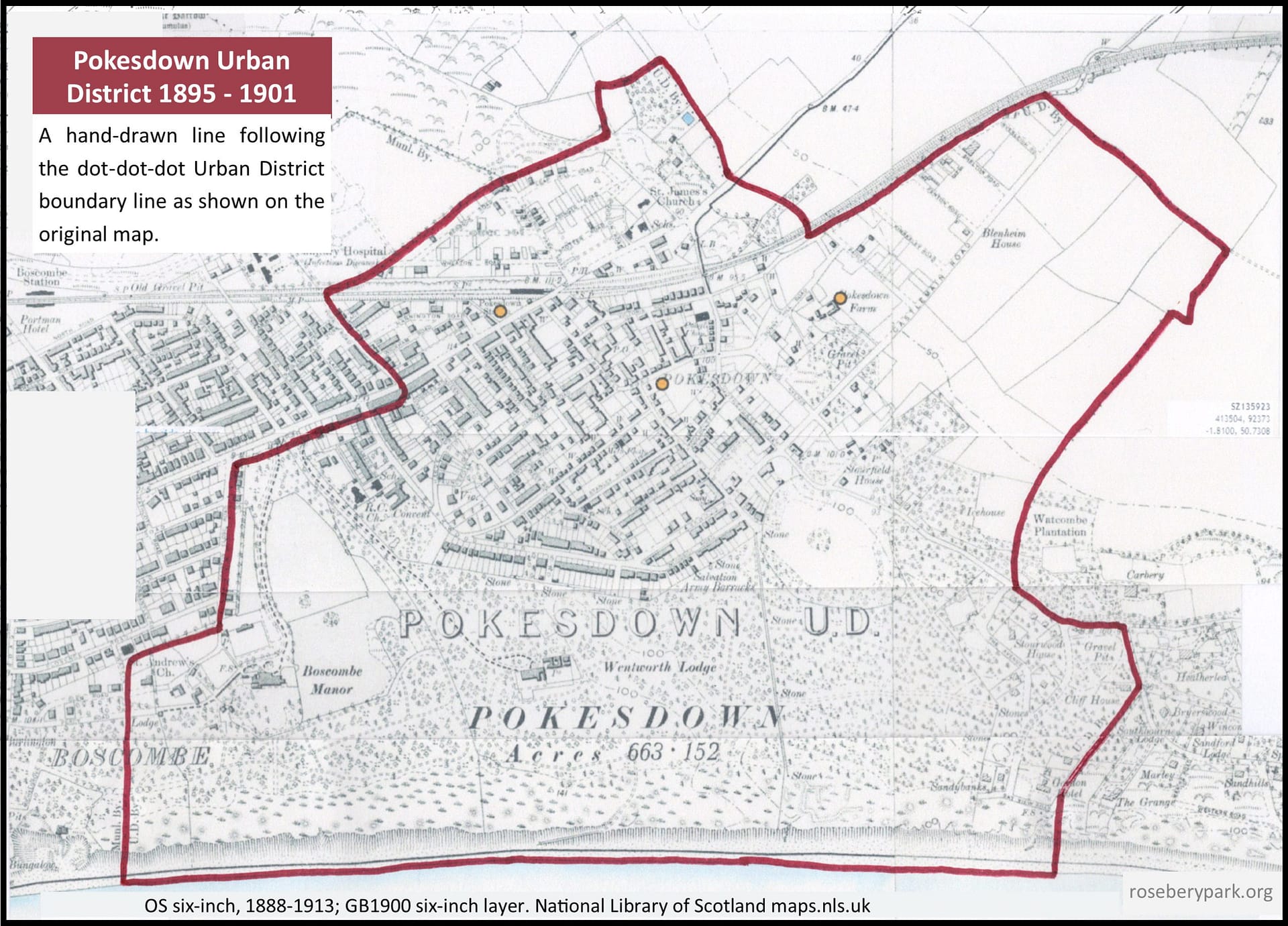
When Pokesdown became an Urban District in 1895, the boundaries were defined as running from the sea front to Wollstonecraft Road, and just east of Crabton Close Road, along south of Christchurch Road to Warwick Road, along the railway, which was crossed to take in Clarence Park, and so over part of King’s Park to beyond Harewood Avenue. It then re-crossed Christchurch Road and the railway, running alongside the line to Cranleigh Road, after which it turned towards Southbourne Road, between Irving and Watcombe Roads. It then turned into Belle Vue Road and along Clifton Road to the sea front. Thus it included the Shelley, Portman, Stourwood and Stourfield Estates.148
Click on image for higher resolution version.
The boundaries of Pokesdown seem to have always been blurry! As early as 1896, Rev. Dr. Moore White stated “for all practical purposes, none can tell where Boscombe ends and Pokesdown begins”149, and in 1916, Mrs Arthur Bell described Pokesdown as “a mere continuation of Boscombe”.150 The boundaries have also retracted, and today’s Pokesdown covers a much smaller area than it did in 1895.
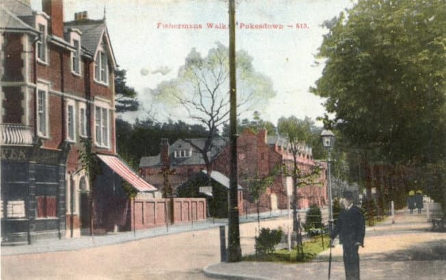
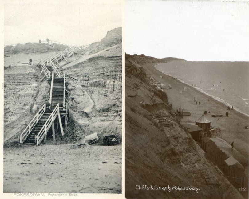
For example, Fisherman’s Walk was originally part of Pokesdown. Where we now have the Fisherman’s Walk Zig Zag to take us down to Fisherman Walk’s Beach (Southbourne), that used to be Fisherman’s Walk, Pokesdown leading to ‘Fisherman’s Steps, Pokesdown’, aka ‘Pokesdown Steps’, leading to Pokesdown Beach! The steps, first constructed in 1891, were replaced by a carefully engineered sloping path in the early months of 1906.150a We can see in the Palladium Cinema advert (on page 3 of History) that the district address of Fisherman’s Walk was given as Southbourne by 1932, which could be evidence that this change happened a long time a go… or it could be another example of someone choosing their preferred district name!
Steps Postcard by Pictorian Stationery, date: c.1905. Source: Alwyn Ladell Flickr Cliffs & Beach, date: unknown, but the refreshment kiosk (the little round hut) was new in 1907. Source: Alwyn Ladell Flickr.
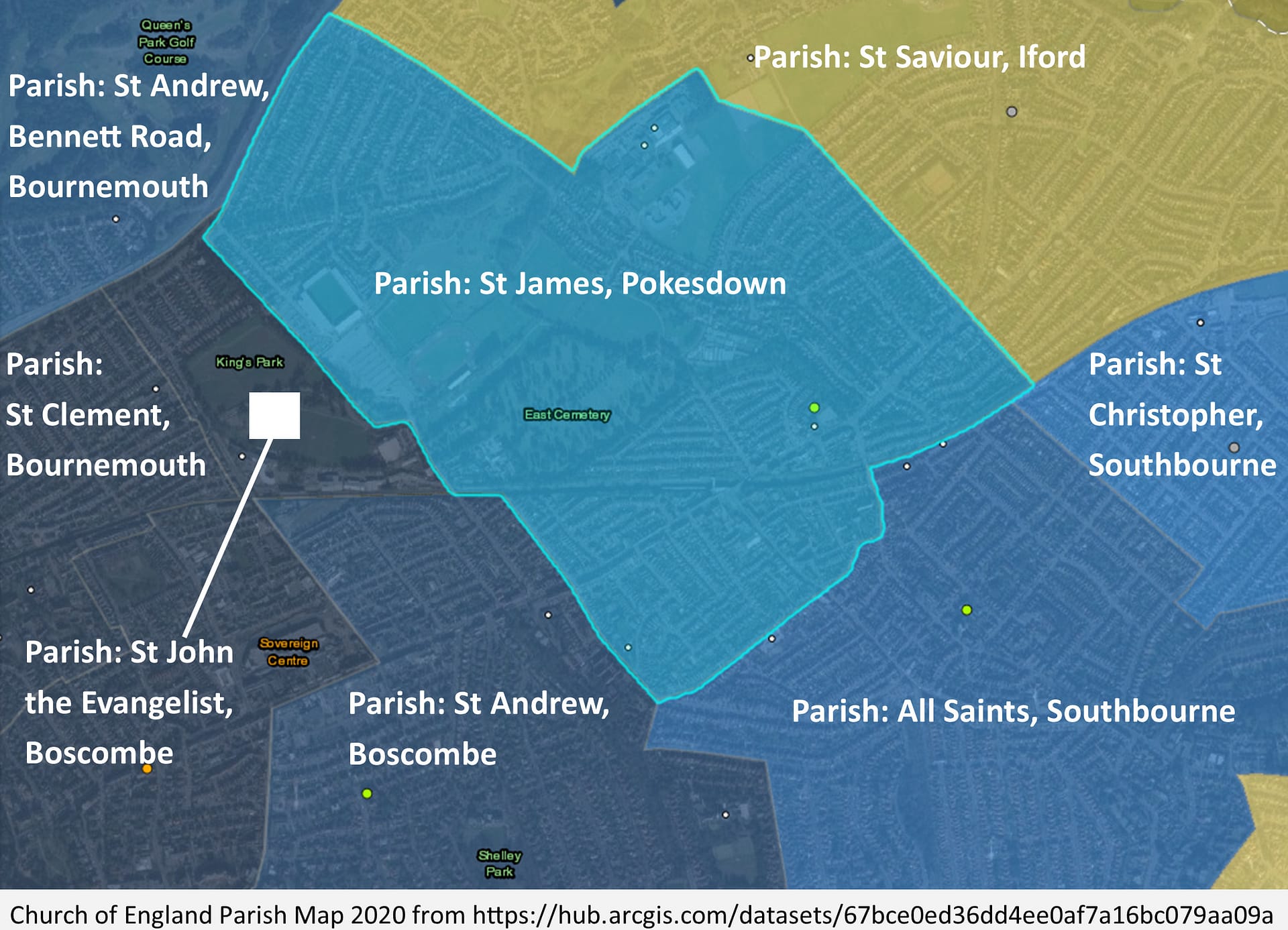
This is the modern-day (2020) parish boundary of St James, Pokesdown. The 1859 parish has, over the years, been divided into multiple parishes:151
Click on image for higher resolution version.
The copy and paste citation for this page: The History of Rosebery Park Baptist Church and Pokesdown – Pokesdown: its boundaries, Page 1. Author: Michelle Fogg. Date: May 2022. Url: https://roseberypark.org/history/pokesdown-boundaries-1/